Earthquake risk prevention - Basel a region with a high earthquake risk
The AUG is working on various earthquake risk prevention projects, including:
- Basel-Stadt earthquake risk model
- Basel-Stadt earthquake microzonation
- Basel-Landschaft earthquake microzonation
- Basel-Landschaft cantonal subsoil class map
The AUG is primarily developing the geological and modeling basis (Figure 1) and making it available for geophysical analyses and the development of ground motion models (Figure 2) by the Swiss Seismological Service (SED) at ETH Zurich.
Once the project is completed, the results will be published on the cantonal GIS platforms in the form of new zoning maps (earthquake microzonation) and the Basel-Landschaft subsoil class map.
Commissioned by: Kantonales Laboratorium BS, Hochbauamt BL, Amt für Militär- und Bevölkerungsschutz BL
Project duration: 2023 – 2025
Horst Dresmann & Brian Steiner
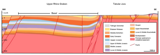
Figure 1: 2D-profile section (west-east) from the geological 3D-model of the Basel region (H. Dresmann, AUG)
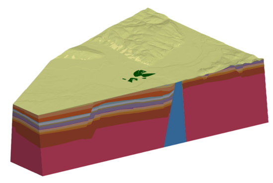
Figure 2: Geophysical ground motion model created on the basis of the geological 3D-model of the Basel region (A. Imtiaz, SED)
Quick Links
Social Media