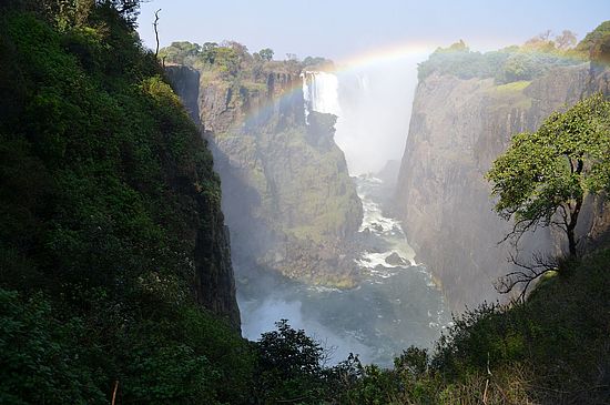

The study area encompasses Namibia (822,634 km2). The background image is a MODIS mean dry season NDVI image (2016), which enhances the presence of woody vegetation since herbaceous vegetation has already senesced.
Remote sensing environmental change in southern African savannahs: A case study of Namibia
Summary
Savannah biomes cover a fifth of Earth’s surface, harbour many of the world’s most iconic species and most of its livestock and rangeland, while sustaining the livelihoods of an important proportion of its human population. They provide essential ecosystem services and functions, ranging from forest, grazing and water resources, to global climate regulation and carbon sequestration. However, savannahs are highly sensitive to human activities and climate change. Across sub-Saharan Africa, climatic shifts, destructive wars and increasing anthropogenic disturbances in the form of agricultural intensification and urbanization, have resulted in widespread land degradation and loss of ecosystem services. Yet, these threatened ecosystems are some of the least studied or protected, and hence should be given high conservation priority. Importantly, the scale of land degradation has not been fully explored, thereby comprising an important knowledge gap in our understanding of ecosystem services and processes, and effectively impeding conservation and management of these biodiversity hotspots.
The primary drivers of land degradation include deforestation, triggered by the increasing need for urban and arable land, and concurrently, shrub encroachment, a process in which the herbaceous layer, a defining characteristic of savannahs, is replaced with hardy shrubs. These processes have significant repercussions on ecosystem service provision, both locally and globally, although the extents, drivers and impacts of either remain poorly quantified and understood. Additionally, regional aridification anticipated under climate change, will lead to important shifts in vegetation composition, amplified warming and reduced carbon sequestration. Together with a growing human population, these processes are expected to compound the risk of land degradation, thus further impacting key ecosystem services.
Namibia is undergoing significant environmental and socio-economic changes. The most pervasive change processes affecting its savannahs are deforestation, degradation and shrub encroachment. Yet, the extent and drivers of such change processes are not comprehensively quantified, nor are the implications for rural livelihoods, sustainable land management, the carbon cycle, climate and conservation fully explored. This is partly due to the complexities of mapping vegetation changes with satellite data in savannahs. They are naturally spatially and temporally variable owing to erratic rainfall, divergent plant functional type phenologies and extensive anthropogenic impacts such as fire and grazing. Accordingly, this thesis aims to (i) quantify distinct vegetation change processes across Namibia, and (ii) develop methodologies to overcome limitations inherent in savannah mapping. Multi-sensor satellite data spanning a range of spatial, temporal and spectral resolutions are integrated with field datasets to achieve these aims, which are addressed in four journal articles.

Study site, including four administrative regions of Ohangwena, Oshikoto, Kavango and Caprivi (yellow) and the Okavango River (blue) in North East (NE) Namibia. The map background is a Landsat 8 Top of the Atmosphere (TOA) reflectance, median composite, 60 m resolution image mosaic comprised of all scenes available for 2015 using the infrared bands 5, 4 and 3. 2.2. Landsat Scene Acquisition and Processing Figure 1. Study site, including four administrative regions of Ohangwena, Oshikoto, Kavango and Caprivi (yellow) and the Okavango River (blue) in North East (NE) Namibia. The map background is a Landsat 8 Top of the Atmosphere (TOA) reflectance, median composite, 60 m resolution image mosaic comprised of all scenes available for 2015 using the infrared bands 5, 4 and 3.
Abstracts
Mapping Decadal Land Cover Changes in the Woodlands of North Eastern Namibia from 1975 to 2014 Using the Landsat Satellite Archived Data
Vladimir R. Wingate, Stuart R. Phinn, Nikolaus Kuhn,Lena Bloemertz, and Kiran L. Dhanjal-Adams
Woodlands and savannahs provide essential ecosystem functions and services to communities. On the African continent, they are widely utilized and converted to subsistence and intensive agriculture or urbanized. This study investigates changes in land cover over four administrative regions of North Eastern Namibia within the Kalahari woodland savannah biome, covering a total of 107,994 km2. Land cover is mapped using multi-sensor Landsat imagery at decadal intervals from 1975 to 2014, with a post-classification change detection method. The dominant change observed was a reduction in the area of woodland savannah due to the expansion of agriculture, primarily in the form of small-scale cereal and pastoral production. More specifically, woodland savannah area decreased from 90% of the study area in 1975 to 83% in 2004, and then increased to 86% in 2014, while agricultural land increased from 6% to 12% between 1975 and 2014. We assess land cover changes in relation to towns, villages, rivers and roads and find most changes occurred in proximity to these. In addition, we find that most land cover changes occur within land designated as communally held, followed by state protected land. With widespread changes occurring across the African continent, this study provides important data for understanding drivers of change in the region and their impacts on the distribution of woodland savannahs.

Study area in southern Africa (a, b); sample sites visited in 2015 adjacent Eenhana (c), and Kakekete (Kandjara) (d); well-developed herbaceous layer (Kakekete) (e); limited herbaceous growth (Eenhana) (f).
Estimating above ground woody biomass change in Kalahari woodland: combining field, radar, and optical data sets
Vladimir R. Wingate, Stuart R Phinnb, Nikolaus Kuhn and Peter Scarth
Maps that accurately quantify aboveground vegetation biomass (AGB) are essential for ecosystem monitoring and conservation. Throughout Namibia, four vegetation change processes are widespread, namely, deforestation, woodland degradation, the encroachment of the herbaceous and grassy layers by woody strata (woody thickening), and woodland regrowth. All of these vegetation change processes affect a range of key ecosystem services, yet their spatial and temporal dynamics and contributions to AGB change remain poorly understood. This study quantifies AGB associated with the different vegetation change processes over an 8-year period, for a region of Kalahari woodland savannah in northern Namibia. Using data from 101 forest inventory plots collected during two field campaigns (2014–2015), we model AGB as a function of the Advanced Land Observing Satellite Phased Array L-band synthetic aperture radar (PALSAR and PALSAR-2) and dry season Landsat vegetation index composites, for two periods (2007 and 2015). Differences in AGB between 2007 and 2015 were assessed and validated using independent data, and changes in AGB for the main vegetation processes are quantified for the whole study area (75,501 km2). We find that woodland degradation and woody thickening contributed a change in AGB of −14.3 and 2.5 Tg over 14% and 3.5% of the study area, respectively. Deforestation and regrowth contributed a smaller portion of AGB change, i.e. −1.9 and 0.2 Tg over 1.3% and 0.2% of the study area, respectively

Trend analysis showing the spatial distribution of significant trends and hot spots of change in percentage woody cover.
Mapping trends in woody cover throughout Namibian savanna with MODIS seasonal phenological metrics and field inventory data
Vladimir R. Wingate, Stuart R. Phinn, Nikolaus J. Kuhn, and Cornelis van der Waal
Woody vegetation is an integral component of savannas. Here, two main change processes alter woody vegetation, namely shrub encroachment and deforestation. Both impact a range of ecosystem services and functions across scales. Accurate estimates of change, including spatial extent, rate and drivers are lacking. This is primarily due to savanna vegetation comprising woody and herbaceous vegetation, each of which exhibit divergent phenological characteristics, and vary importantly in their response to climatic and environmental factors. This study uses phenological metrics derived from the MODIS MOD13Q1 NDVI time-series to model woody cover as a function of field measurements, and map trends across Namibia. These metrics enhance the contrasting phenological characteristics of woody and herbaceous vegetation, and minimizes their response to climatic and environmental factors. Trends in woody cover are excellent indicators of shrub encroachment and deforestation. Trend significance was computed using the Mann-Kendall test, while change statistics, including the rate and spatial extent of change were derived using the Theil-Sen slope. Change was evaluated in relation to drivers including land-use, population, biomes and precipitation. An overall decrease in woody cover was identified, with the most pronounced decreases found in urban and densely populated areas. Decreases in woody cover were not homogenously distributed; losses predominated in tropical desert and dry forests, but gains were found across shrub lands.

The distribution of annual slope (km2 yr-1) in corrected NDVI, extracted for mean annual precipitation (1983-present) with 100 mm bins.
Mapping precipitation-corrected NDVI trends across Namibia
Vladimir R. Wingate , Stuart R. Phinn, Nikolaus Kuhn
Savannas comprise a major component of the Earth system and contribute ecosystem services and functions essential to human livelihoods. Monitoring spatial and temporal trends in savanna vegetation and understanding change drivers is therefore crucial. Widespread greening has been identified across southern Africa; yet its drivers and manifestations on the ground remain ambiguous. This study removes the effects of precipitation on an NDVI time-series, thereby identifying trends not driven by rainfall. It utilizes the strong correlation between vegetation and precipitation as captured using MODIS and rainfall estimates. A linear regression between variables was used to derive its residual (corrected) time-series, and the rate and spatial extent of trends were evaluated in relation to biomes. A random sample-based qualitative interpretation of high spatial resolution imagery was then used to evaluate the nature of the trend on the ground. 31.83% of the country, including all biomes except tropical desert, exhibited positive trends. Results agree with studies finding widespread greening unrelated to rainfall and indicative of shrub encroachment. They are likely related to a reduction in woody species richness, loss of the large trees and a shift towards drought tolerant shrub species. 10.20% of the country exhibited negative trends; these were mostly associated with the desert biome, in agreement with recent research, where vegetation loss is associated with land degradation. They manifested as vegetation clearing, identifiable using high resolution multi-temporal imagery. Greening trends could not be identified using this approach; instead, they point to the occurrence of gradual vegetation change caused by indirect drivers.
Quick Links
Social Media