Land Degradation in South Africa
Land degradation in drylands is recognised as a global environmental problem that affects ecosystem services negatively. It is mostly prominent in the form of soil degradation, which is defined as a decline in soil quality, caused by soil erosion, contamination, acidification or salinisation amongst other processes. The lack of globally consistent information on the extent of dryland degradation is a major source of uncertainty in assessing their current role within the global carbon cycle and projecting drylands’ future change.
Drylands are characterised by a sparse vegetation cover that is often arranged in a regular or irregular heterogeneous pattern of vegetated and bare soil patches. This is also reflected in heterogeneous chemical, structural and textural soil properties. This highly dynamic spatial heterogeneity is not depictable on soil maps and conventional landscape mapping is very time- and labour intense. Also emerging technologies, as satellite imagery, are not sufficient to detect the small-scale patterns in these heterogeneous landscapes yet. Hence, detailed spatial data on soil types or degradation features are missing. However, it is crucial to evaluate the relevance of processes affecting soil quality, soil redistribution and biogeochemical cycling in semi-arid landscapes.
To address these knowledge gaps, the objectives of the project are the documentation of small-scale heterogeneity in semi-arid rangelands using unmanned aerial vehicle (UAV) data to assess the relevance of human-induced degradation and the development of a method for mapping and quantifying degradation.
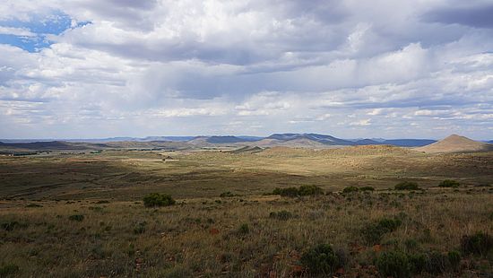
The Karoo rangelands of South Africa are representative of a semi-arid ecosystems and were chosen as a study site. The landscape is particularly vulnerable to erosion due to the seasonality of rainfall, its impact on vegetation, and the occurrence of drought. Land degradation results in enhanced soil erosion by overland flow and the development of gullies, by sediment export through river systems, or by deflation. The widespread erosional features of various shapes and degrees, such as silted-up reservoirs, incised sediment, badland and gully formation, make this area an ideal study site, where soil redistribution through erosion and deposition has happened and is still on-going.
Involved people:
- Juliane Krenz
- Philip Greenwood
- Goswin Heckrath
- Brigitte Kuhn
- Nikolaus J Kuhn
Related Publications:
- Krenz, J., Greenwood, P., Kuhn, N.J., 2019. Soil Degradation Mapping in Drylands Using Unmanned Aerial Vehicle (UAV) Data. Soil Syst. 3, 33. doi.org/10.3390/soilsystems3020033
- Krenz, J., Kuhn, N.J., 2018. Assessing Badland Sediment Sources Using Unmanned Aerial Vehicles, in: Badlands Dynamics in a Context of Global Change. Elsevier, pp. 255–276. doi.org/10.1016/B978-0-12-813054-4.00008-3
- Krenz, J., Kuhn, N.J., Kuhn, B., Greenwood, P., Heckrath, G.J., 2017. Kohlenstoffkreislauf und Landschaftswandel in der Grossen Karoo - eine methologische Betragtung. Reg. Basil. 58, 167–174.
Quick Links
Social Media